Glossary of Aviation Terms | Aeronautical Charts
Aeronautical Charts | Paramount Business Jets
Aeronautical charts assist the crew in the navigation of the aircraft. Much like a roadmap provides the driver of a vehicle with critical information about location and direction, an aeronautical chart is a tool that helps a pilot determine the following flight information:
Safe altitude
Position
Navigational aids along the way
The shortest route to a destination
Alternative landing spots in case of an emergency
Airport information, including usable runways
Topography and elevation
Contact information for weather advisory services
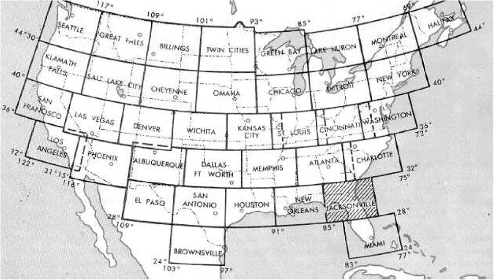
These charts are broken up into sections that cover all land masses on Earth, and long-distance charts for trans-oceanic travel. For example, pictured here is the sectional break-up of the continental United States:
Since it is very common for a trip to call for travel from one end of a continent to the other, or even to destinations abroad, the flight crew will always be prepared with an aeronautical chart for every section of land that the flight path will pass over. This allows the crew to plan out the aforementioned details of the trip to ensure safe and on-time arrival at the destination.

Explore More Aviation Terminology
- True Airspeed | Paramount Business Jets
- Airport | Paramount Business Jets
- Duty Time | Paramount Business Jets
- Vertical Separation | Paramount Business Jets
- General Aviation | Paramount Business Jets
- FBO | Paramount Business Jets
- Class G Airspace | Paramount Business Jets
- Jet Stream | Paramount Business Jets
- KTAS | Paramount Business Jets
